
Satellite technology to anticipate and assess extreme geodynamic events
Prevention and management of natural disasters
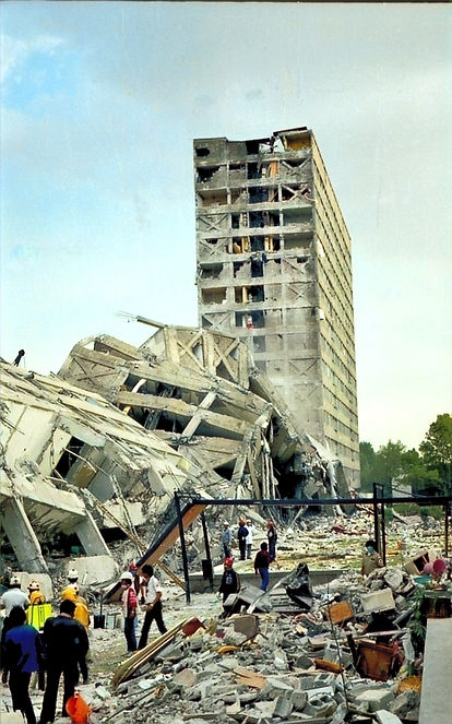
Mexico is one of the countries most exposed to natural disasters in the world. Every year, phenomena such as earthquakes, volcanic activity, hurricanes, landslides, and subsidence generate significant impacts on the population, infrastructure, and the economy. Given this scenario, satellite monitoring using InSAR techniques offers a key tool for anticipating risks and assessing damage quickly and accurately , allowing authorities, technicians, and decision-makers to act based on evidence and reduce the consequences of these events.
Thanks to multi-temporal satellite monitoring, we provide objective, georeferenced information that allows us to detect changes in the terrain before they are visible to the naked eye, as well as to quantify structural or geomorphological damage following a disaster.
InSAR applications in risk management
-
Pre-seismic assessment and monitoring of active faults
Monitoring of subsidence in urban areas associated with water extraction, geological activity, or intensive urban development.
-
Monitoring active volcanoes
We detected inflation or deflation of the volcanic edifice, deformations in domes or crater rims, as well as subsidence associated with hydrothermal systems or magmatic intrusions.
-
Monitoring unstable slopes and landslide-prone areas
We observe gradual movements that may precede mass removal processes in urban and rural areas, or infrastructure in mountainous regions.
-
Rapid assessment after extreme events
After an earthquake, eruption, or heavy rainfall, we compare pre- and post-event images to detect differential displacements, fractures, collapses, or zones of instability.
-
Support for response and reconstruction systems
We provide validated geospatial information to prioritize inspections, locate temporary shelters, or redesign damaged infrastructure.
Key benefits
-
Millimeter detection of geodynamic precursors.
-
Monitoring in inaccessible or risk areas.
-
Quantification of post-event displacements.
-
Direct support for civil protection and disaster management plans.
-
Useful information for declaring emergency or high-risk zones.
-
Ideal complement to seismic, geotechnical and meteorological data.
Typical use cases
Localities located on active faults or subsidence zones.
Active volcanoes with eruptive history or recent deformation.
Roads, railways or pipelines near unstable slopes.
Regions exposed to extreme rainfall, hurricanes or tropical storms.
Post-earthquake damage assessment of slopes or dams.


EOSAR Mexico has the experience to conduct these types of studies, as its founders have collaborated with civil protection agencies, governments, NGOs, and international organizations to strengthen disaster risk reduction systems, improving response capacity before, during, and after catastrophic events.
Natural disasters are a constant threat to human life, infrastructure, and ecosystems. At EOSAR Mexico, we apply advanced InSAR techniques to provide key tools at two critical moments: early prevention and post-event assessment.